Sunday, January 6, 2013

Athens Big Fork Marathon - This One Is Difficult

Races that are billed as particularly difficult within their specific class are always intriguing to me, and I know that I'm not the only person who is easily drawn in by a race that is inherently difficult. It's the same syndrome that results in people who might otherwise be considered sane and reasonable turning into masochistic freaks and "running" "events" such as Barkley. To be very clear, the Athens Big Fork Marathon does not reach any of the extremes that makes Barkley such an unreasonable feat, nor does it attempt to present itself in the same manner. Athens Big Fork is a race that can be completed by reasonably fit and adequately prepared and experienced trail runners without undue risk to health, and with comparatively moderate amounts of mental torment. Athens Big Fork is, however, a great "moment of clarity" race for anyone with an inclination in the back of their head that maybe it would be sort of cool to try Barkley some day, just to try it. What I mean by this is that it will almost certainly convince a person with any delusions about the enormity of an event like Barkley to never, ever, ever even think that considering participating in such a thing is reasonable, much less fun.

My perspective on this became clear to me yesterday as I was nearing the end of the Athens Big Fork course, considering that I had just run up and down steep mountains on poorly marked and maintained trails contending with deadfall, briars, jumbled rocks, and cold damp weather for somewhere between four and five hours. In comparison, Barkley is 60 hours of far, far worse versions of the same sorts of conditions. It was in that moment that my understanding and appreciation of the physical and mental extremes experienced in some of the toughest ultra endurance events expanded just a little bit, and I was once again humbled by the relative normalcy of the challenge that I was about to complete.


The back-story to how I came to run the Athens Big Fork Marathon originated in the intrigue of it being a difficult event. Back in November I was looking for a race to run in early January. My criteria were to find a course near marathon distance in a place that I could find inexpensive transportation to with a course that looked both interesting and at least moderately difficult (sorry, no repeating butterfly loops through the 8 mile trail system of some state park). There were a few options that caught my eye but once I began looking at the events in detail I was immediately drawn to the description for the Athens Big Fork race. For starters, it appeared to be a very low profile event with a simple website describing very basic information on the event, the route of the course, and past results for the race. The website also presented the disclaimer that the race is very difficult and is designed for experienced and well prepared trail runners. The race is billed at 26.2 miles and 9200 feet of elevation gain, however both of these statistics are up for debate. No pre-registration is available for the event, and the registration process on race morning consists of signing a waiver, picking up a number, and dropping a donation into a box for the Big Fork community center which allows the race to use their facility. The picture that was painted by the sparse information I was able to pick up from the race website and race reports from past competitors deepened my level of intrigue, and before long I had decided that this was a race that I must do.

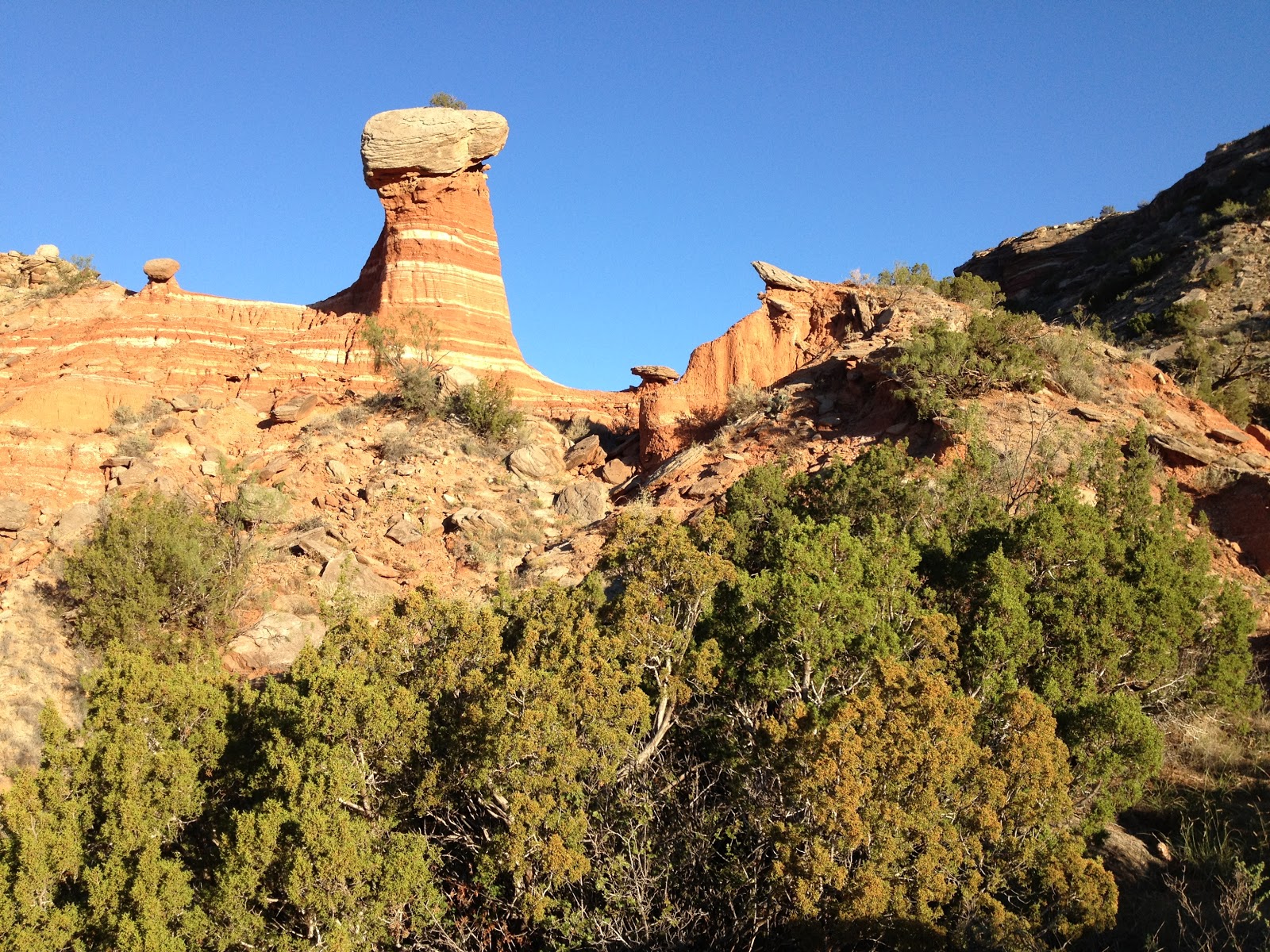
After arranging my travel plans and doing the routine preparation leading up to the race, I finally began my journey. On January 4, the day before the race, I flew to Tulsa and made the four hour drive to the tiny town of Big Fork, Arkansas in the middle of the Ouachita Mountains. I arrived in Big Fork in the early evening and drove to the beginning of the trail that I would be running on the next day. I wanted to scout the course just a little bit in order to give myself an idea what I was getting into, so I threw on my running shoes and headlamp and headed out up the first hill. The course for the race consists of an initial ~2.5 miles on paved and dirt roads before reaching the beginning of the trail. Once on the trail, the route follows a pattern of steep climbs and steep descents over 8 distinct mountains before reaching a county road and the turnaround point. The route then reverses back over the same 8 mountains, and back along the roads the final miles to the finish. The portion of the course that I scouted in the dark the evening before was the first and last of these sixteen sets of climbs and descents. I learned during my recon mission that the trail appeared to be lightly traveled, not well blazed, and fairly overgrown in places. I did, however, note a few pieces of pink ribbon strung along the trail that appeared to be course markings, along with white blazes on the trees which are the official markings for the trail. I could definitely see how losing the route would be a very easy thing to do, but I was somewhat assured by my preview of the course.


I camped that night at the trailhead and in the morning made my way to the small community center along the state highway that runs through Big Fork. After registering and getting my gear together, I jogged up and down the road a bit to get my legs ready to move. At about 7:45 the race director called all of the 100 or so participants into the community center to give the pre-race briefing, which mostly consisted of instructions of how to avoid getting lost on the course. The instructions seemed clear enough at the time, but I remained leery after hearing stories of most people doing significant off-route mileage at least once during the race, even if it wasn't their first time running the course. After the briefing, we made our way out onto the road and the race director said something to the effect of "let's go" and we were off running.

I settled in with a group of three others just behind the leaders as we ran up the road and enjoyed some good conversation. When we hit the first climb, the conversation mostly stopped as we pushed a good running pace to the top of the first hill. At the top of this hill, I moved ahead of the small group I had been running with and let gravity take over while keeping an easy but fast pace on the descent. I quickly caught up to the two leaders along with another guy who had stayed directly behind me, and the four of us grouped into a pack that we would keep together for the next 11 miles.

For the next several climbs and descents we traded leads several times among our group of four, and I started getting to know the guys who I was running with. It turns out that one of the guys in our group, Tom, is a many time winner and long time course record holder for Athens Big Fork. I felt comfortable with the pace that our group was keeping and it was easy to let the miles and the hills roll by as we had some good conversations. At the aid station at mile 8.5 after the fifth climb, I chose to run through and in doing so put a small gap on the other three behind me. The gap would not last long however, since at the top of the next climb I became confused about the direction we were supposed to descend, and Tom yelled out directions to me as he neared the top with the others. This pattern continued for the next few hills: I would maintain a short lead but then get confused and have to stop and try to determine the correct trail to take, then Tom would yell out to me which direction I should be going, and then I would take off once again.

The turnaround for the course was a short run up a county road after exiting the trail at the bottom of the 8th descent, and our group of four came into and left the turnaround aid station all together. Once we were back on the trail, however, was when the wheels started to come off for me, and as we made our way up that next climb I quickly fell behind the others. The onset of fatigue had come relatively quickly and I was now hiking grades that just a few minutes before I would have comfortably been running up. By the time I got to the top of the first climb after the turnaround I had lost sight of the others and had determined that I needed to pay attention to maintaining my own condition rather than focus on catching back up to them.

As I ground through the next couple of climbs, passing by the rest of the marathon runners still on their way out, I slowly began to realize that the reason for my fatigue was probably largely due to not having kept up with my nutrition well enough during the first half of the race. I had been drinking perpetuem, but not enough of it, and I had neglected to take any gels or salt tabs. I began downing gulps of my perpetuem mix more frequently and added in a gel and a couple of salt tabs periodically, and after a short while I could begin to feel their effect kicking in and I began returning to life to some degree.

Through most of the return trip I was able to stay vigilant of the places where we had made turns on the way out that I would have to repeat on the way back. I had also brought along a topo map of the course area with the approximate route of the trail marked on it, which I referenced several times to make sure that I was turning the right direction in the proper places. Despite my care to stay headed in the correct direction, I encountered a bit of confusion about halfway through the return trip when I reached a creek at the bottom of a descent. I knew that I was supposed to turn left to head upstream in the valley so I crossed the creek and started up what appeared to be a trail, but the trail quickly disappeared into a thicket of trees. I then spotted what looked like a trail a bit further south in the narrow valley and bushwhacked my way over, just to find that there was no trail there either. After double-checking my map I determined that the trail must have stayed on the opposite side of the creek so I bushwhacked back across the valley and across the creek, then quickly found the trail running along the opposite side. I feel very fortunate that this was my only off-trail mishap of the day, as I talked to many runners later who had ventured much further off route, many multiple times.

With three climbs left to go on the return, my general fatigue level continued to grow higher but some of the deadness in my legs was subsiding due no doubt to the aid provided by the salt and gels. As I finished out the last of the climbs I was truly dreading those last miles on the road to the finish. At that point I would have much rather faced another climb or even two rather than having to push out those miles on the flat road. When I hit the road, it hurt just as badly as I had imagined it would. My body was taking a beating with every step, but it would have been ridiculous to slow to a walk or a shuffle at that point on such easy terrain so I made every effort to push it out and maintain some semblance of a decent pace. As I turned onto the asphalt and neared the finish, a wave of relief hit me and I was finally able to celebrate the fact that I would get to stop running.


I crossed the finish line to the rowdy cheers of three people sitting in the back of an SUV next to the finish. I stumbled into the community center, wrote down my name and my time on the yellow legal pad of results, and plopped down in a chair. Tom, who had once again won the race, was curled up on a bench nearby, appearing to be in a good bit of pain. Josh and Cole, the other two guys I had been running with were sitting by the wood burning stove with their shoes off, looking a little bit dazed. Thus is the effect of running for hours through rough and indistinguishable terrain.

It didn't take long before we all started regaining our normal faculties and started discussing all of our individual experiences with the course. As the rest of the runners began trickling in we discussed and rehashed all of their experiences, and so it went for the next few hours. Despite being small in total numbers for the race, the support among the runners for their fellow competitors finishing the race was fantastic. Even though the weather was still somewhat cold, a crowd maintained their position near the finish line cheering in every finishing runner and filling the time between runners with sharing stories and having a general good time. One guy, upon finishing the race, made the comment that he had matched his personal best 50 mile race time, which is an impressive feat depending on how you look at it.

My closing thoughts on the race event are all very positive. I truly enjoyed the laid back community feel of the event which encouraged conversations rather than competitiveness. The course was just as tough as its reputation had suggested. I have tried to make a comparison in my mind between this course and other routes that I've completed with similar overall statistics such as Barr Trail, Four Pass Loop and others, but it's difficult to make a comparison because of the unique nature of this particular route. I've never done a route of any distance with so many distinct climbs and descents, and that factor alone sets this race apart from most others. Factoring in the grade and quality of the trail, as well as the general setting of the course, makes it one of a kind in my experience.

Friday, December 21, 2012

Inov-8 F-lite 195 Shoe Review

Despite the fact that the Inov-8 F-lite 195 has been highly praised as a crossfit shoe since its initial production, and in fact Inov-8 itself now designates the model along with the rest of its crossfit specific line, I have felt the need to publicize my view of this shoe for its originally designed purpose - as a crossover trail running shoe. For a year and a half now, the F-lite 195 has been my go-to shoe for trail and mountain races up to marathon length, and for several half marathon to marathon length road races. I've also used the shoe some as a trainer on the roads. Despite having many other shoe options that I consider adequate for racing, I've continually turned to the F-lite 195 to carry me through a variety of surface conditions and distances, all while handling the intesity of racing.

The picture below was taken immediately after the F-lite 195s destroyed the old mining building in the background.


For those unfamiliar with the F-lite 195, it was originally produced as an ultralight trail running shoe with minimal features and a crossover tread that allows the shoe to perform on both trails and roads. It the exact same shoe as the highly praised X-Talon 190 with the exception of the outsole - while the X-Talon 190 outsole contains deep, widely spaced lugs to handle thick mud and wet grass, the F-lite 195 has lower profile lugs that handle basically everything else. At 195 grams (6.9 oz), it is one of the lightest running shoes on the market that is specifically built for trails, and is arguably (depending on whose measurements you trust) the lightest trail running shoe available with a foam midsole.

By my count, I've competed in 26 races while wearing the F-lite 195s. These races have ranged in variety from a cross country 5k to a road marathon, and every type of trail and mountain race imaginable within this distance range. In an effort to give a fair assessment of my experience with the shoes, I'd like to profile a number of the races that I've competed in while wearing these shoes, and use that basis to outline what I believe to be the highlights and limitations of the shoes. I'll say from the outset that I have never finished a race wearing the F-lite 195s and wished that I had chosen a different shoe. On the contrary, I have finished races wearing other shoes that I thought would perform better in the given race conditions and wished that I had chosen the F-lite 195s instead.

Xterra Beaver Creek Trail Race - July 2011
Distance: Half Marathon
Terrain: Dry, packed dirt mountain trails and roads typical to Colorado
Comments: This was the first race I ran in these shoes, and in fact was only the second time I had run in the shoes at all. This is where I first fell in love with these shoes. The course terrain was the type that I still consider to be what these shoes are ideally suited for - dry dirt trails without an over-abundance of rocks and roots, with substantial climbing and descending.

Pikes Peak Ascent - August 2011, August 2012
Distance: 13.3 mi
Terrain: Asphalt road, dirt road, dry trails, rocky trails, all uphill
Comments: For the last two years I've chosen the F-lite 195s for the Pikes Peak Ascent, and will continue to do so if I run the race in the future. The shoes have continued to prove themselves ideal for any type of dry conditions, such as are typical in this race. I should note that if I were to do the full Pikes Peak Marathon - both up and down the mountain - I would most likely choose a shoe with some additional protection for the downhill portion, such as the Inov-8 Trailroc 245.

Breck Crest Marathon - September 2011
Distance: 24.5 mi
Terrain: Dry alpine and sub-alpine mountain trails
Comments: This is the longest distance mountain race that I have completed in the F-lite 195, and was in fact the longest race of any type that I had done at the time. The shoes performed beautifully over the distance coupled with the substantial elevation gains and losses over the rough trails. If I were to run this race again today, I may be inclined to choose a slightly more protective shoe - maybe one with a rock plate - but certainly wouldn't object to relying on the F-lite 195.

Denver Rock 'n' Roll Marathon - October 2011
Distance: 26.2 mi
Terrain: Flat asphalt roads
At the time I ran this race I had been putting in some training miles on the roads in the F-lite 195, and had very comfortably raced a road half marathon in these shoes two weeks prior to the marathon, so the decision was easy to stick with the F-lite 195s. In the end, the shoes performed very well and were the best option that I had at the time for this race. Since this time I've begun doing all of my road training in the New Balance 730, which I've come to prefer for longer mileage on the roads. If I were ever inclined to run a road marathon again, I would most likely run in the 730s rather than the F-lite 195s simply because of my current adaptation to using these shoes for the roads.

Sportspectrum Trail Run - January 2012
Distance: 10 mi
Terrain: Flat, muddy trails
This was the first race I ever ran in the F-lite 195s where the terrain could easily be described as a mud bath. The flat mountain bike trails winding through the state park in North Louisiana had collected significant amounts of water from recent rains, and the surface had become a mixture of thick, sticky mud and loose, sloppy mud. Since I didn't have any other shoes with me at the time, my mind was made up for me as to which shoes I would wear, but I'm inclined to think that the F-lite 195s are the best choice that I could have made even if I had a wider selection. Given the option, I probably would have chosen to run the race in the X-Talon 190s because of their superior ability to handle thick mud, but I honestly don't know if I would have felt any more comfortable in those shoes than I did in the F-lite 195s.

Below, the F-lite 195s are seen guiding me to another race finish line, despite my best efforts to take all of the wrong trails and become hopelessly lost and off-route.


Based on my experience with the F-lite 195s, I've found that they are a superior option in a number of types of running conditions, distances, and terrains. For my preferences, the F-lite 195s are ideal as a racing shoe moreso than a training shoe. When training, especially on trails, I prefer a shoe that will provide more cushioning and protection, and is more of a comfort fit design. I'm willing to sacrifice these aspects to some extent when it comes to racing, so the "stripped down performance" nature of the F-lite 195 becomes ideal in these times. I see the F-lite 195 as being an ideal racing shoe for up to marathon length races, but would probably not be suitable beyond this distance for many people. The reason, once again, is because of the "stripped down performance" design of the shoe, which eliminates some protective and comfort features that become important in the longer distance races. The shoe is ideally suited for any type of terrain that can be described as "dry." While it certainly has the ability to handle mud, wet rocks, wet grass, etc... there are other shoes that are more specifically designed for these other terrains. Overly rocky courses have potential to cause problems with this shoe because it contains a thin foam midsole and lacks any rock protection, so the possibility of foot bruising is increased. The tradeoff of a lower weight, less protective shoe will become more significant on a rocky course the longer the distance is, and at some point (for me at about the half marathon to 25k distance) a more protective yet slightly heavier shoe will probably become ideal when racing on very rocky trails.

I have heard some complaints that the F-lite 195s lack good durability, but I find that they are largely comparable in durability to other high performance racing shoes, and in fact are more durable than many other shoes in their class. They are also very easy to repair when the high wear areas of the shoe begin to fail. I've found that I can usually count on getting 200-300 racing miles out of a pair of these shoes, with many additional miles of life remaining outside of using them for racing. Another feature of these shoes that I've always found superb is their ability to drain water quickly. This has been a very useful feature in races with lots of water crossings or standing water, and ensures that my feet will not be weighed down from hauling around excessive water loads in my shoes. On the whole, I consider the F-lite 195s to be an ideal trail racing shoe for the types of races I compete in most often. Only occasionally do I feel the need to supplement with a more protective or differently designed shoe as dictated by the course conditions, and I find the F-lite 195 to be largely suitable for most marathon and lower distance trail races.


Saturday, December 15, 2012

A Whirlwind Tour of the Marin County Trails - Coyote Ridge Race Report

Last weekend I had the pleasure of spending 50 wonderful hours in Marin County north of San Francisco. My primary excuse for making this trip was that I had a canceled reward flight booking that I needed to use before the end of the year, and the Coyote Ridge trail race in the Marin Headlands just so happened to coincide with this particular weekend. I had actually planned before to make the trip the weekend prior for the North Face Endurance Challenge Championship, but due to real-life logistics happening to me, I was delayed by a week. This turned out to be a great thing in the end since The North Face event was largely an exercise in misery and disappointment (by no fault of the organizers), and the race distance that I would have been running ultimately ended up being canceled.

My weekend in Marin Co was, however, faced with its own challenges; namely a sickness that I had started to feel coming on the day before leaving Denver for the race. I spent the majority of Thursday and Friday before leaving focused on convincing my body to not become sick. It only marginally worked, and as I flew to San Francisco I was accompanied by some nasty body aches and lack of any real energy. Despite feeling lousy, I was still able to appreciate the beauty of watching the sun set on the Sierra Nevada mountains as we flew over them.


After arriving in San Francisco, I got into my rental car and drove directly north across the Golden Gate Bridge, and felt immediately relieved to be outside of the crazy cluster of a city that is San Francisco proper. I stopped at a grocery store in Mill Valley and picked up some of the essentials I would need for the weekend including two pounds of chicken wings and a six pack of delicious IPA from 21st Amendment Brewing that just so happened to contain some the best beer label artwork I've ever seen.


Since it was very dark and I was interested in doing little other than preserving every bit of energy that I could for the next day's race, I made my way along the dark and winding Hwy 1 to the Muir Woods road and settled on a nice roadside pullout where I could set up lodging for the night inside the Hotel Camry. When morning came, I realized that some of the aches in my body had subsided to some extent. I got out of the car and walked up and down the road a bit, and although I was still far from feeling energetic and lively, I was in a place physically where I knew I could at least start the race and just see how I felt from there.

After making my way to the start area at the Muir Beach parking lot, I began warming up on the initial section of the course, which would serve both as the beginning and end of the race course. I always like to warm up on the initial and final sections of a race course if possible in order to gain familiarity and comfort with the terrain and to visualize and plan how the crucial beginning and finishing sections of the race will play out. On this course, the beginning of the course was a steep climb out of Muir Beach on a fire road that still contained plenty of mud from the previous week's Pineapple Express storm system. As I climbed up this hill and looked down to see the ocean waves crashing into the cliffs below me, I finally started to feel myself become more lively and excited to start racing. I still didn't know how my body would hold up, but I was ready to give it a good solid effort for as long as I could.

I was doing the 20 mile distance, which was the middle of five distances offered in the race event. The reason I chose the 20 mile is because it was the longest distance that consisted of a single loop without repeating sections or re-visiting the starting line before actually finishing. The more trail races I do, the less tolerant I'm becoming of uninspired multi-loop courses on uninteresting terrain. I applaud the efforts of every race director and course setter for using the trails available to them for putting on an event, but not every event is going to present itself as interesting enough for me to make the effort to participate in, and for me the quality of the course is the overall most important deciding factor. This particular 20 mile loop in the Marin Headlands did not at all disappoint my standard for a beautiful, interesting, and exciting race course.

As the race started, two guys doing the 10 mile race bolted up the first climb, and I found myself hanging back at an easy effort level with two other guys climbing steadily. As we crested the first steep hill and dropped toward Pirates Cove, I began to really feel the thrill of running returning to me. With the sun rising, the clouds lifting off the surrounding mountains, and the waves crashing below me, the setting was just as I had imagined and hoped that it would be. During this section I passed one of the guys I had been running close to since the start, and found out he was doing the 50k race. He must have decided he had started too quickly because he slowed down considerably on the descent and subsequent climb out of Pirates Cove, and soon I was not aware of anyone close behind me, with only the two 10 mile racers still in front of me. After descending to Tennessee Valley and running up the road to the trailhead, the 10 mile runners split off to ascend the Old Springs trail, while I would be ascending the Marincello fire road.

Once turning onto Marincello I again became aware that there was no one close behind me. I began to think that this may be a very different sort of race and that it was a real possibility I would not see any other competitors until after I finished. I decided to enjoy not being pushed to race hard at this stage and settled into a nice easy effort in the climb up the road. I felt great on this climb and probably enjoyed this section of the course more than any other, with the occasional views through the clouds of the bay below and Mt. Tamalpais to the north. After the climb up Marincello, the route began a traverse filled with shorter ascents and descents along the mountains, staying generally on the west side of the crest with views of Rodeo Cove far below. As the route began descending toward the southern portion of the Coastal Trail which would lead to Bonita Point, I glanced behind me and for the first time in several miles saw another runner. I decided I had no reason to push myself to try to stay in the lead at this point, especially since I didn't even know whether this guy was in my race distance or if he was a marathon or 50k runner.

After stopping briefly at the Bonita Cove aid station to refill water, the route led in a short loop on the road around Bonita Point, and after exiting the loop I was able to see several other runners coming down the road about to enter the aid station. This reassured me that there were others still running this race. After rounding Rodeo Lagoon and just before beginning the climb out of the valley, the runner who I had previously seen behind me came quickly up to me and passed me. We exchanged a few words and confirmed we were both in the 20 mile race. As we started the climb, the runner ahead of me was moving very well and seemed to be comfortable keeping a good pace on the climb. I stayed a little more conservative on this climb since at this point I was aware that I was starting to become more fatigued and I knew that the current climb and last climb on the course would be the two most difficult sections.

As the guy ahead of me slowly pulled away, I focused on continuing to enjoy my race and not feel pressured to chase him down. At this point I was just thankful to be running the race at all and was more than happy to be in the position I was in, so there was no need to over-work myself. The race continued over Wolf Ridge, down a short section of the Miwok trail, then down the Old Springs trail back down to Tennessee Valley. Back on the Tennessee Valley road, the guy in front of me was only about a minute ahead, but I could tell that he was still running comfortably. I stayed at an easy effort down the road in order to save my remaining energy for the last climb up the Fox trail fire road. I figured that if I had enough energy left in me maybe I could catch the guy in front, and if not, he had been running admirably well and deserved to win. The final climb up the Fox trail was made tough by exposure to the sun which was now warming everything considerably, but I still felt solid through the climb. Despite putting in an honest effort on this climb, I wasn't able to make up any time on the lead, and by the time I crested the hill and began the final descent down the Coastal fire road, I had resolved to cruise into the finish and happily take second place. Even though I was thoroughly tired at this point, I was able to enjoy and savor that last descent and crossed the finish worn out but happy - just as it should be.

I had put in a solid, consistent effort through the whole race and it had paid off in my final time of 2:53:00, which I was pleased with. I had figured before starting the race that I would be doing well with a time under 2:55, and considering that my body was physically not at its peak due to being sick, I was more than happy with my time. Having never run in the Marin Headlands before this, I now understand what all of the hype is about, and I can see why so many races choose these trails to conduct their events on.

Later that afternoon, I decided to explore one of the coastal sections of trail at the southern end of the Point Reyes National Seashore. My goal was to take the run nice and easy and be able to watch the sun set over the ocean as I ran along the cliffs above.


I don't often get the chance to run in coastal mountain areas, and to be able to run up and down the hills while remaining directly next to the ocean shore is a real treat for me.

The views both to the south and the north along the coast were fantastic as the sun dropped lower in the sky, and as I made my way up the trail I was constantly drinking in the beauty of the surroundings.


I came to my turnaround point a few miles up the trail at a small, peaceful lake which was perfectly calm and reflective.

On my way back down the trail, I stopped several times to watch the sun drop over the ocean and to take pictures of the scene this was creating.


I had taken the run very slowly and could tell that my body was tired from the race that morning, but that I was recovering well and that the following day I should be able to put in some decent miles on the trails that I still wanted to explore. The next morning I was awake as soon as it was light and on my way to Muir Woods National Monument. I had to park alongside the road since the park had not yet been opened, and as I made my way along the boardwalk through Muir Woods, I was thankful to be the only person around. I'm sure that the experience would have been diminished if I had been forced to share it with thousands of tourists clogging the boardwalk.

Attempting to capture the beauty and scale of the old growth redwood stands inside Muir Woods without some decent camera gear was difficult to say the least. I had never seen old growth redwoods and the sight that they provided was truly remarkable. Even though having the designation of National Monument causes this place to become a tourist trap, I am glad that these unique stands of trees have been preserved in the manner that they have so that they can continue to inspire and be enjoyed by many people.

After leaving Muir Woods I climbed up the valley on the constantly branching and converging trail system to the Pantoll ranger station, along the way continually enjoying the cool lush foliage around me, and the continuing stands of impressive trees.

From Pantoll, I began traversing then descending the Matt Davis trail toward Stinson Beach far below. The views along the trail opened up as I dropped down the mountainside, and I enjoyed the sight of the green mountainside in front of me slowly falling away to meet the shore of the ocean below.

Some of the lush growth within the narrow drainages that the trail dropped through made the descent very enjoyable, and gave a lot of variation to the scenery.


Once in the town of Stinson Beach, I made my way onto the beach and spent a little time just watching the peaceful morning unfold up and down the long crescent shaped beach.

I made a visit to the small grocery store in Stinson Beach and got a breakfast burrito, which I munched on while sitting in the quiet town park. Once I finished eating, I made my way back up the hill out of town and caught the lower end of the Dipsea trail, which I would follow back over the mountain to Muir Woods. The vegetation and views along the Dipsea trail didn't disappoint, and neither did the famous flights of stairs that I had read so much about.

As I ran the Dipsea trail from Stinson Beach to Muir Woods, I considered and attempted to envision running the historic race that takes place along this trail every year in the opposite direction, from Mill Valley to Stinson Beach, and took note of some tricky sections of the trail. It certainly seems as though running down all of the flights of stairs toward Stinson Beach would make the run very tricky, and good skills at descending stairs would be needed in order to do well in the race. Before reaching Cardiac, I stopped briefly to admire the views to the south across the Marin Headlands and down to the San Francisco peninsula, with Sutro Tower visible beyond the city.

This iconic view embodies so much of what I've come to enjoy about running trails in this area of the world. As I descended the last of the trail to Muir Woods and crossed Redwood Creek, I was disappointed that my short visit was coming to an end, but at some point I'll take an extended visit to the area to explore many more of the beautiful and distinct trails that this region offers.

Wednesday, November 28, 2012

Getting Lost and Running Wild in Penitente Canyon

Penitente Canyon is truly a hidden gem as a trail running destination in Colorado, especially during the months of the year when the higher mountains are buried under deep snow. I recently made my very first visit to the area despite having driven past on US-285 dozens of times over the last five years during my commutes from Denver to Creede. Given that I've never had a particularly strong inclination to sport climbing, the canyon did not hold a great deal of interest to me until I found out about the trail network that had been developed in the area which had become increasingly popular among mountain bikers.

The view below is seen from atop the plateau that the many small narrow canyons spill from. On this day the clear weather allowed for views across the San Luis valley to the high peaks of the Sangre de Christo range, and including the Great Sand Dunes which can be seen on the right side of the photo below.


Penitente and the adjacent canyons are not very deep, but they are lined with an abundance of jumbled sandstone rock formations and are littered with high desert foliage.


The area of Penitente Canyon was for many years a refuge for Los Hermanos Penitentes, a sect of Spanish Catholicism, from which the canyon receives its name. Surviving evidence of this heritage can be seen in the image of the Virgin Guadalupe painted on one of the prominent rock faces in the lower canyon.


It's worth noting that the trail system within and surrounding the canyons can be somewhat confusing since the signage placed at trail intersections does not strictly match the trail maps for the area. Additionally, a few of the trails can be very indistinct and difficult to follow at times, and developed climbers trails often lead to dead-ending, albeit interesting, side canyons.

The views from above the canyons are endless on a clear day, as shown below from the top of the Rock Garden trail with a view across the San Luis valley southeast to the Blanca Peak massif.

I particularly enjoyed running the Rock Garden trail because many segments of the trail contained no definite track as they followed cairned routes over slickrock and through narrow slots. The trail finally ended up in a side canyon where the rock features provoked closer inspection.


After climbing back onto the plateau above Penitente Canyon proper, I proceeded on a loop route that eventually led into the higher foothills to the west of the canyon area. The views below are of Bennett Peak and Pintada Mountain - the most northeasterly of the high peaks in the South San Juan mountains.


I had taken a picture with my phone of the trail map which was posted at the entrance to the trailhead and was reliant on this for reference since no printed trail maps were available and the trails in this area are not shown on any common area maps. Due to some indistinct and poorly signed trail intersections, I ended up getting myself wonderfully lost for several miles until I found myself 1000 feet above the canyons on a nice soft dirt trail leading deeper into the National Forest. I assume that this connector trail, and possibly others, connect to existing trails maintained within the National Forest among the higher foothills of the La Garita mountains further to the west. After a frustratingly long time spent attempting to find a trail intersection for the Witches Canyon trail, I finally discovered the correct path and was rewarded with a descent into a tight canyon choked with foliage and a "trail" which led over huge boulders, through caves and arches, and across rock fins before dropping into a sandy canyon bottom lined with even more fascinating rock sculptures. The rock formation below, which I've nicknamed "The Hound" for obvious reasons, is an example of the crazy rock formations within the Witches Canyon area.


In total I covered approximately 12 miles of trail during my initial exploration with only minor retracing of routes required in a few areas. There are many additional trails within this area that I did not have a chance to visit this time, but I plan to stop and explore the area more regularly now that I'm informed of the quality trails it contains. If you're ever in the area, I encourage you to do the same.


Thursday, October 25, 2012

Palo Duro Canyon - Running the Wild Frontier

One day last week I was able to escape from the job site I was working on in the Texas Panhandle and spend the morning running through Palo Duro Canyon. My memories of this area go back to family camping trips when I was very young, and it had been many years since I've been here.


 Since those early visits, I've developed a love for exploring desert landscapes, especially those involving canyons, to an extent that comes close to rivaling my love for the mountains. I've spent long hours running through the desert canyon areas of Utah and Arizona, among other less notable areas, and have come to consider the wild places in northern Arizona and southern Utah to be the standard to which I compare every other similar place that I visit. By this comparrison, Palo Duro Canyon does not come near the same level as Canyonlands, Capitol Reef, or the Grand Canyon; however it is by far the best canyon area there is in Texas, and is beautiful and rugged in its' own right.


The developed trail system within Palo Duro Canyon state park is extensive enough to accomodate a run lasting several hours without re-visiting any trails, and the trails are arranged so that many different combinations of loop routes can easily be pieced together. On this trip, I primarily ran on the network of developed trails in the central section of the park. Along the way, I identified a number of other primitive trails, game trails, and dry washes that could be followed if a longer expedition venturing into some of the more remote areas of the park are desired.


The red sandstone formations which rise up along the canyon walls give relief to the sometimes green, sometimes brown growth of cedar trees which line the bottoms of the canyons.


In the dry times of the year, the vast majority of the creeks within the park dry up and leave exposed their sandy and rocky paths like the one shown below, which can be followed all throughout the park to access some of the smaller, more remote side canyons.


Many of the developed trails in the park see heavy use by mountain bikers. The Little Fox Canyon trail is one of these, and along a remote portion of this trail a rustic rest stop/meditation area of sorts has been built within a small grove of cedars, and features dozens of toys and trinkets hung from the branches of the trees. This must be the type of thing that only mountain bikers can truly appreciate, because I just found it sort of creepy.

 
Possibly the most notable natural feature within the park is the Lighthouse - a 300' red sandstone tower with a high bench connecting it to a prominent fin that I don't know the name of.


The connecting bench between the Lighthouse and the large fin was a fantasic area to sit and admire the surrounding beauty. I felt like a kid, full of energy and free of worry, running around the smooth sandstone formations and the soft sandy slopes in this area.


The mostly dry wash below was just too intriguing to avoid exploring, and I spent some significant time off-route exploring the path of this interesting little canyon.


The perfectly cool fall weather I experienced during my run provided an excellent setting for this adventure. In an area of the state with few things that I consider worth seeing or doing, taking a run through Palo Duro Canyon stands out as an anomoly in the most positive of ways. I'm hopeful that during one of my upcoming trips to this area that I'll be able to take some additional time to escape to the canyon and explore some of the more primative and remote areas that I did not get to visit on this trip. Until then, I guess running around Black Canyon and Moab will have to suffice.


Friday, October 19, 2012

Conundrum Hot Springs - Experiencing the Aspen Fall Colors

I recently spent the weekend in Aspen, CO taking part in some fantastic runs. My timing happened to coincide with the peak of the fall colors in the Roaring Fork valley. As one may guess, the town of Aspen and the surrounding area is littered with huge groves of aspen trees that turn bright golden yellow during the fall. Over the weekend, I was able to run the Golden Leaf Half Marathon and take a nice run to Conundrum Hot Springs.

The Golden Leaf Half Marathon begins at the base of the Snowmass Village ski resort, and after climbing up the ski runs within the resort, traverses across single track trails to the town of Aspen. The only slight deterrent to the amazing views of the fall colors was the slight haze of smoke from the fires in Wyoming and Idaho, but this was a minimal bother. The race itself was an excellent event and is one that I'll make a priority to try to run in the future - hopefully improving on a somewhat "flat" performance, yet still enjoyable experience, this year.

Saturday night I camped at the Conundrum Creek trailhead and waited until full light in the morning to begin my run up the trail. I didn't want to miss out on any of the views I knew would be in store for me. The run up and down the ~9 mile trail to Conundrum Hot Springs was absolutely spectacular with the fall colors. The second highlight of the run in addition to the fall colors was breaking up the running with a nice long soak in the hot springs at the head of the valley with a number of people who had backpacked in for the weekend. The weather was perfect for this sort of activity, and the warm water worked well to relieve some of the soreness in my legs from the prior day's race.

In lieu of attempting to narrarate the details of my run up Conundrum Creek, I'll let the photos speak for themselves. I've decided this is one of those runs that will go on my "must repeat as soon as possible" list.