The Short Version
I've become sensitive to the fact that sometimes I use a lot of words, and that some people don't like reading very many words. For those people, here is a brief synopsis of this trip report: I ran the Maroon Bells Four Pass Loop last Saturday. It was awesome. I swam in three alpine lakes and took over 150 pictures, only 25 of which are uploaded here because the others were too awesome for the internet and would make your monitor explode. I finished the run with a cannon ball into Maroon Lake and ruined some guy's $3000 camera with the splash but that's OK because he was rich so he high-fived me and invited me to the crazy party he was having at his mansion in Aspen that night. I politely declined because I had another crazy mansion party to attend that night, but I told him I'd hit him up the next time I'm in town and we can go buzz around in his Gulfstream or something.
The Real Version
Above my bed I have a print of a painting of the Maroon Bells. In my living room I have a print of a painting of the south side of Snowmass Mountain, Hagerman Peak, and Snowmass Peak. The Elk Mountains are second only to the San Juans in terms of extensive rugged beauty in the Colorado high country, and the heart of the Elk Mountains would be my setting for this adventure. The Maroon Bells Four Pass Loop is a roughly 25 mile route that circumnavigates the Maroon Bells massif, traversing some of the area's most beautiful terrain along the way. As the name implies, the route involves crossing four high alpine passes, all of which top out at approximately 12,500'. Between the passes, the route dips into the alpine and sub-alpine terrain of the separating basins, which during the summer host an abundance of wildflowers and other green vegetation. As Phil Mislinski states in his Trail Runner's Guide to Colorado: "The Four Pass Loop may well be considered the ultimate Colorado trail run."
I pulled into the Maroon Lake trailhead parking lot Friday evening just in time to catch the last light lingering high on the north face of North Maroon Peak. The iconic view of the Bells from Maroon Lake is a sight that never grows old. There is a reason this is the most photographed view in all of Colorado.

The next morning as I began heading up the trail and the sun began to rise, the Bells once again became illuminated, and my eyes were continually drawn to the view.

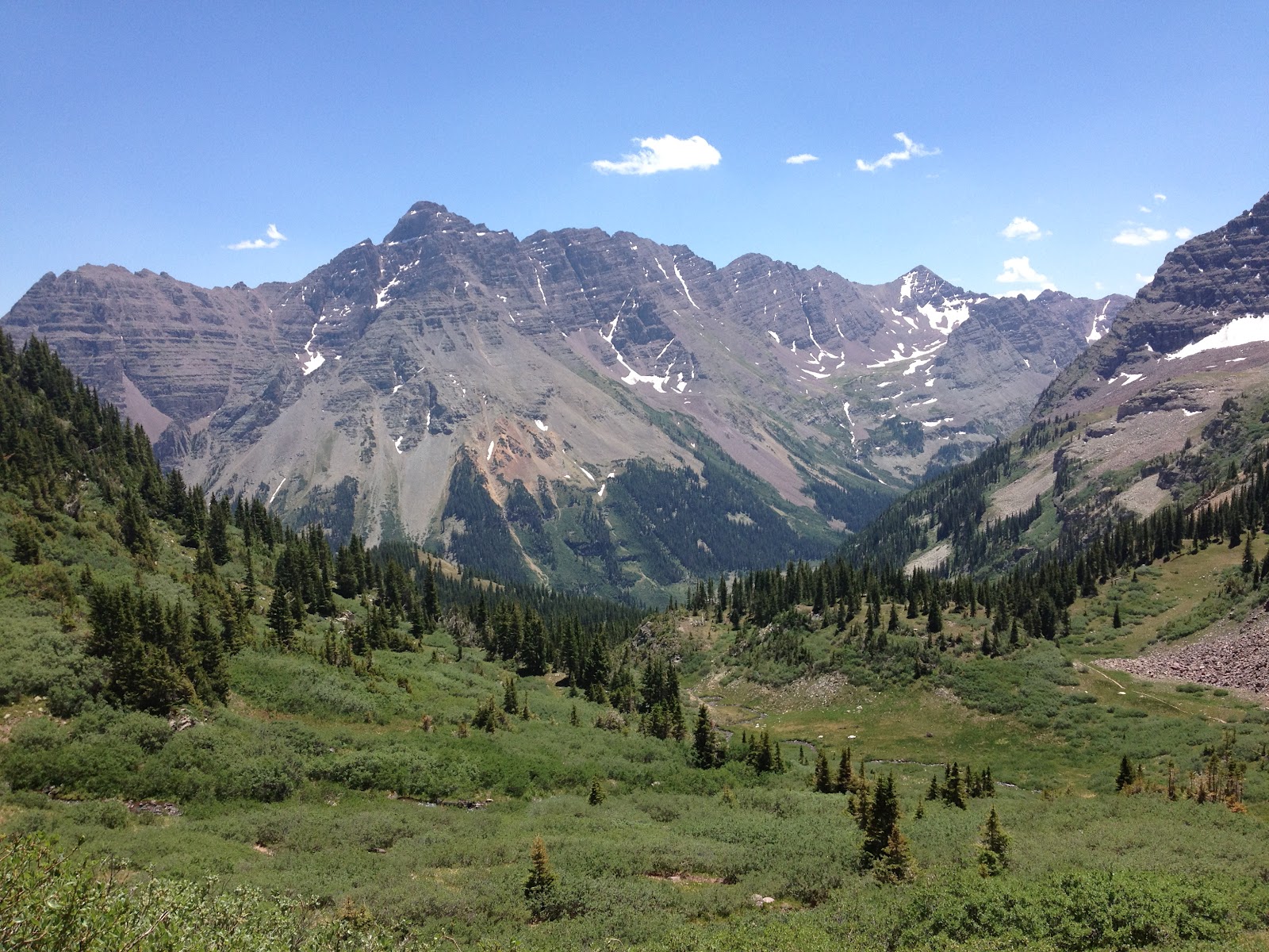
As I continued up the West Maroon Creek drainage, I felt buried within the deep valley between the Maroon Bells massif and the Pyramid massif. After several miles, the views opened into the upper West Maroon Creek valley and the wide expanses offered great views in all directions.

The hulking mass of Pyramid Peak, Thunder Pyramid, Lightning Pyramid, and Len Shoemaker Ridge loomed over the eastern end of the basin.

Once on top of West Maroon Pass, I stole one last look back toward Belleview Mountain and Maroon Peak.

The first descent of the day into the upper East Fork of the Crystal River Basin was made quickly, and I was soon traversing across the upper basin and began the (relatively) short climb to Frigid Air Pass.


As I climbed higher toward the pass, the views of the high mountains to the southwest grew more spectacular.


As I topped out on Frigid Air Pass and began descending into Fravert Basin and the North Fork of the Crystal River, the greenery around me became almost overwhelming. The best description I have heard of Fravert basin is that it's "So green as to make Ireland envious."


As I followed the North Fork down through the basin, I found myself below treeline for the first time in approximately seven miles. After passing by several small waterfalls, I began to hear the roar of the one I had been waiting for: King Falls.

Because of the routing of the trail, it's difficult to catch a glimpse of the falls until you're well below and across a small basin from them. I determined that I needed to find a route up to the base of the falls. Because both sides of the creek below the falls are choked with thick willows and above those slopes are rocky cliffs, the most feasible route to the base of the falls was to climb up the creek itself. By the time I reached the base, my feet were numb and I was mostly soaked, but it was well worthwhile.

As I began the climb toward Trail Rider pass, the view of Maroon Peak and North Maroon Peak and their connecting ridge came into view, framed above upper Fravert Basin.

This is my attempt at an artsy wildflower shot.

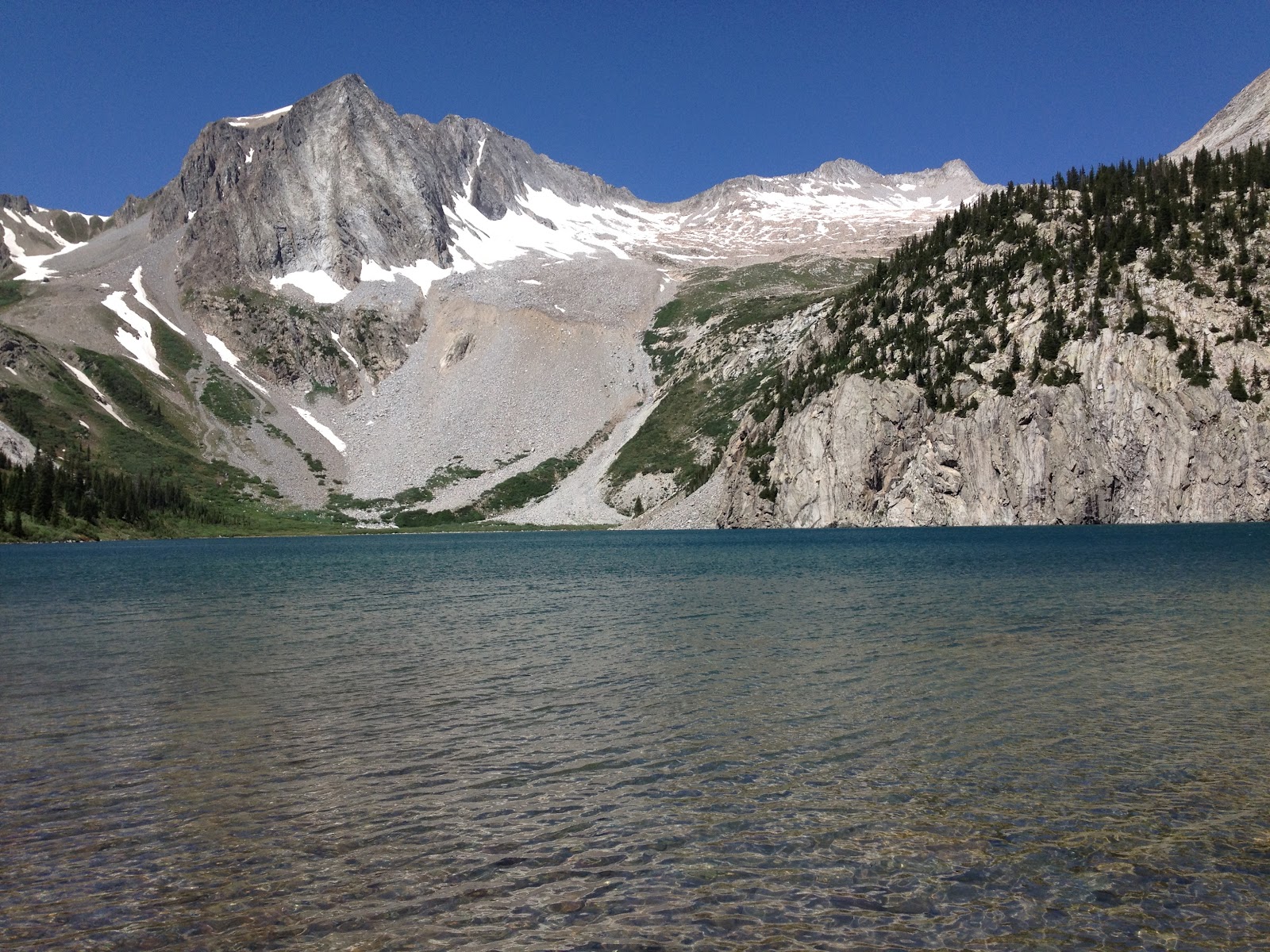
After crossing a high ridge, the final stretch to Trail Rider pass came into view with a small alpine lake below. Of course I had to take this opportunity to stop and go for a swim. The lake was surprisingly warm (and by warm, I mean it was probably at least 40 degrees) and I took my time lounging on the shore after my swim.

Shortly after leaving the high lake, I was greeted by the sentinel of Trail Rider Pass.
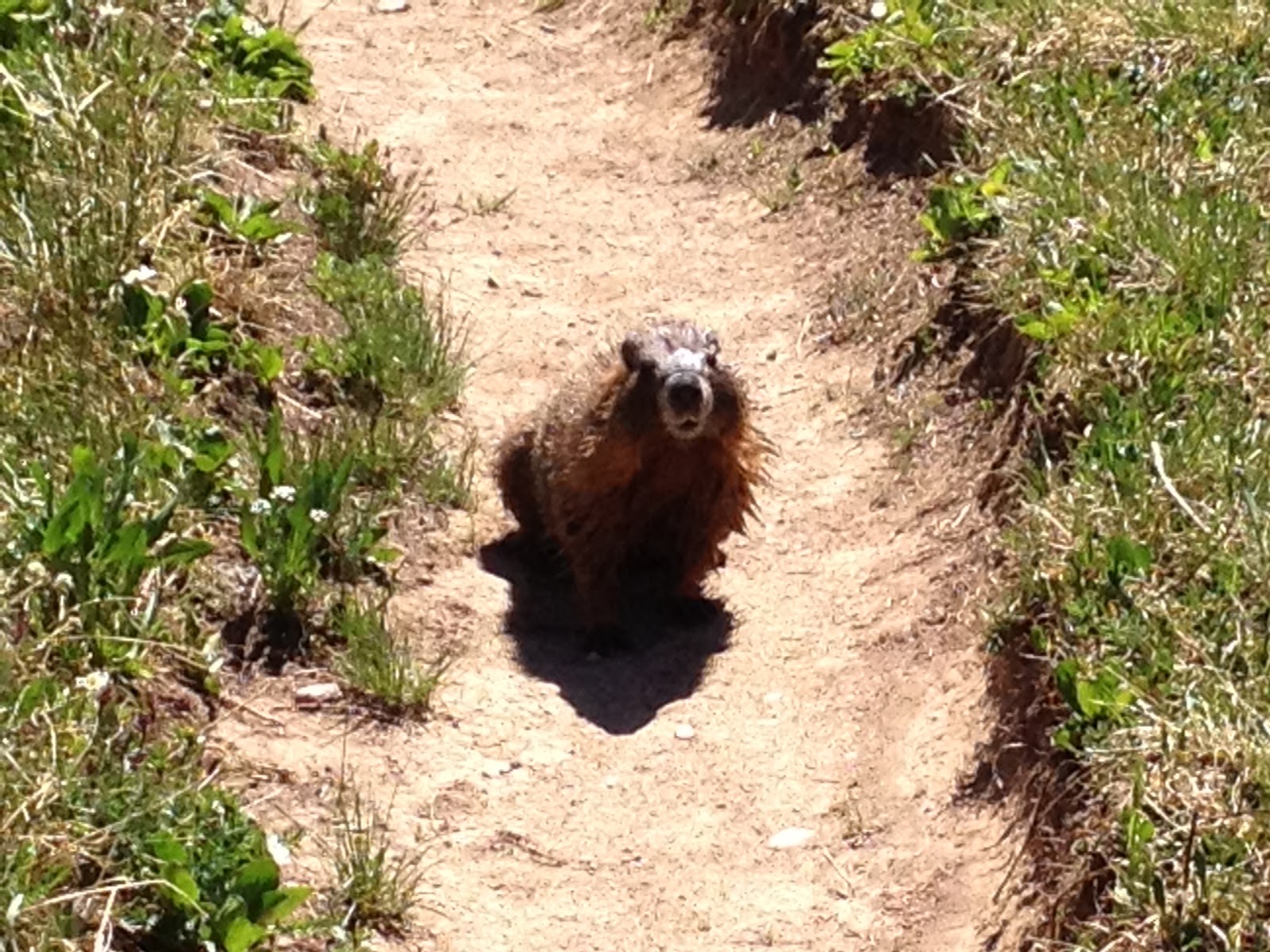
Here's a little known marmot fact: marmots are approximately the same size, shape, weight, and structure as a regulation NFL football, which makes them excellent for punting or place-kicking. As an added bonus, they elicit a satisfying squeak upon foot-to-belly impact. After sending the little vermin spiraling neatly into the willows, I made the last steep push up to Trail Rider pass and was instantly rewarded with the views of Snowmass Lake below.

The view of Snowmass Peak and Snowmass Mountain from Snowmass Lake is one of my favorites.
After leaving Snowmass Lake and beginning the last climb of the day to Buckskin Pass, the fatigue of the day began to set in heavily, but I was helped along by the fact that the views behind me of Snowmass Mountain and Capitol Peak became more spectacular the higher I climbed.

After cresting Buckskin pass, I was greeted with perhaps the best views of the day: to the south were the north faces of North Maroon Peak and Sleeping Sexton, and to the east was Pyramid Peak and all of its' sub-peaks.

A nice waterfall in upper Minnehaha Gulch below Buckskin Pass served as my last water refill spot of the day, and I was able to quickly descend back to the lower basin of West Maroon Creek.

After reaching the trail junction at Crater Lake I began the final mile descent back to Maroon Lake, but not before snapping one last photo of the Bells.

This is a tremendously fun route to do as a single day run for someone who is in good shape. It's a tough route, but the beauty of the setting makes the difficulty well worthwhile. I have received varying opinions from people on preferences for doing the route in the clockwise or counter-clockwise direction. For this run I chose the clockwise direction and am glad that I did. No matter what starting point or direction you use for the route, the first climb will be the biggest. By going clockwise I extended the elevation gain of that first climb over more miles, which made for an easier warm up to the day. I have heard (and believe it) that descending West Maroon Pass at the end of the run when going counter-clockwise can be fairly miserable, while the alternative descent from Buckskin Pass only required that I keep my legs moving and let gravity do the work. The only pass that I imagine might be easier going in the counter-clockwise direction is Trail Rider, and even then I believe the benefit would be marginal.
What's left to say about this route? You have to do it for yourself - I guarantee you will not regret it. If you do regret it, just drop-kick a marmot and you'll instantly feel better.
Please tell me you were not serious about the Marmot punting?
ReplyDeleteThose are seriously awesome pictures. 4 Pass Loop is definitely a Colorado life list item.
This comment has been removed by the author.
ReplyDeleteThis comment has been removed by the author.
DeleteMarmot's are fun,i think 25 yards is my record,it drifted a little bit to the left. If your running Lost Lake race up in Seward Alaska,i moved down from there to Colorado,if you need a place to stay ,my cabin is empty,i now it would be an expensive trip.
Delete